Wednesday, April 5, 2023
The discovery of New Guinea island
New Guinea is the world's second-largest island, after Greenland, covering a land area of 785,753 km2.
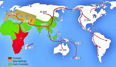
Papuan habitation of the region is estimated to have begun between 42,000 and 48,000 years ago.
The first definite European sighting of the New Guinea island was in 1512, when Portuguese sailor Antonio d’Abreu sighted the coast.
In 1526–27, the Portuguese explorer Jorge de Menezes accidentally came upon the principal island in the Biak archipelago and is credited with naming it Papua, from a Malay word pepuah, for the frizzled quality of Melanesian hair. Heading east, he eventually reported the northern coast of the Bird's Head Peninsula and the Waigeo Island, and named the region Ilhas dos Papuas, Islands of Papuans.
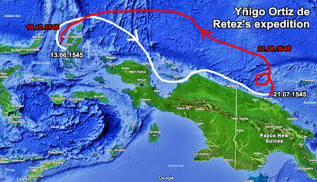
On 13 June 1545, Ortiz de Retez, in command of the San Juan, left port in Tidore, an island of the East Indies and sailed to reach the northern coast of the island of New Guinea, which he ventured along as far as the mouth of the Mamberamo River. He took possession of the land for the Spanish Crown, in the process giving the island the name by which it is known today. He called it Nueva Guinea owing to the resemblance of the local inhabitants to the peoples of the Guinea coast in West Africa.
In 1606 Spanish navigator Luís Vaz de Torres sailed along the southwestern part of the island in present-day Papua, and also claimed the territory for the King of Spain.
After some failed attempts to establish a colony, the Spanish interest in the western Pacific come to an end.
Eager to protect incursions into the eastern end of Dutch East Indies Empire, modern-day Indonesia, the Dutch East Indies Company claimed sovereignty over unexplored New Guinea in 1660. And so it remained for more than a century.


